Mountains, Lakes, and Body Aches
Hiking the Canadian Rockies
(This email is very long and is thus likely get truncated. You may want to open in a web browser to make sure you see the full thing.)
I’m not sure exactly how it transpired that I came to enjoy hiking so much. I did a modest amount of it as a child. Family vacations often (but not always) involved trips to destinations of natural beauty. And those vacations would typically involve a day-hike or two. I continued this pattern into my solo adulthood travels, including one big hike each on my trips to St. Lucia (the Gros Piton) and Newfoundland (Skerwink Trail).
But our time in the Canadian Rockies on this trip was built around hiking every day. And we more or less fulfilled that goal (until the weather intervened on the last two days). I can’t imagine any place better to spend endless time in the outdoors than here (writing occurring in a café in the town of Canmore, just southeast of Banff National Park). Every stream, lake, river, mountain, valley, forest, meadow, plain, and plateau seems to have some grandeur or majesty about it that I have never encountered elsewhere.
What follows is a chronicle of our pedestrial adventures in the Canadian Rockies.
Day 1, Valley of the Five Lakes
Parks Canada maintains a listing of the official trails through the national parks, complete with a rating of difficulty (easy, moderate, difficult, and extreme) and an updated assessment of the trail conditions (good, fair, poor, and a variety of other sub-poor ratings pertaining to dangerous conditions). A cold spring and late snowfall meant that many of the more ambitious hikes we had identified in advance were listed as in “poor” condition (or worse), so we began with a “moderate” hike in “good” condition.
The Valley of the Five Lakes is a hike south of Jasper town, and seemingly other people had made the same calculation we had. The parking lot was reasonably crowded, and we encountered plenty of other people on the trail, but not so many as to make it feel mobbed. This would turn out to be the most crowded hike we did in Jasper.
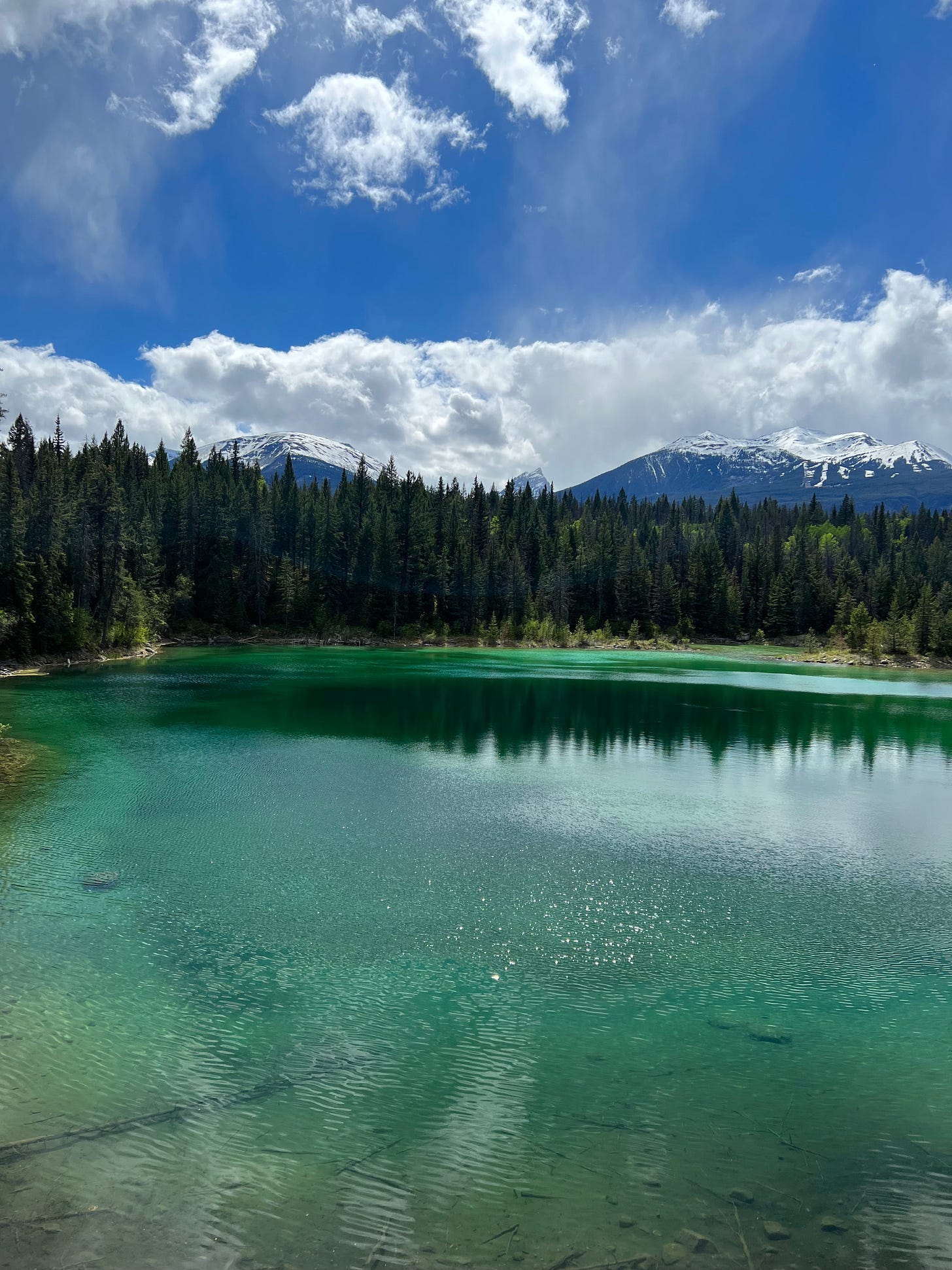
The trail itself goes out east of the Icefields Parkway before diverging to make a loop around the middle three of five lakes arranged north to south from 1 to 5. We opted to go to the south first, catching a glimpse of an unnumbered lake on our way out to the north end of lake 5.
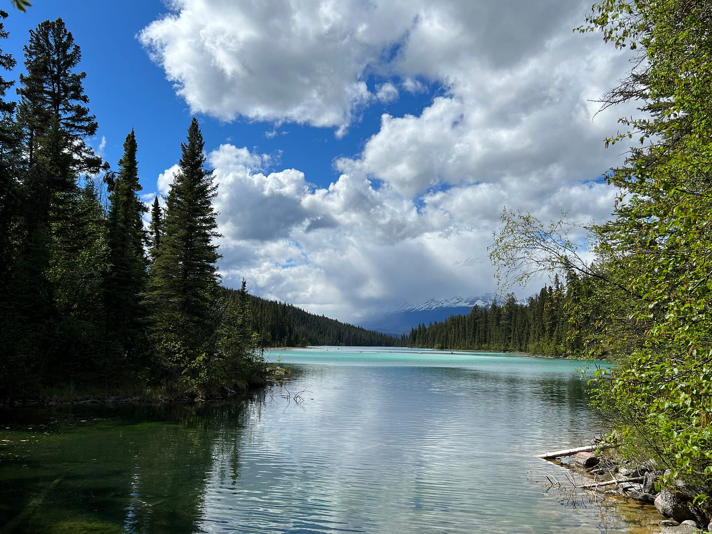
The trail involved a decent amount of up and down, but the lakes were worth the (Parks-Canada-defined) “moderate” amount of effort. Each had a slightly different color (dependent primarily upon depth).
Lake two was a bit ugly, actually, but lake 1 (the largest) was a beautiful capstone to the hike. There was a longer (10 kilometer) loop that we could have added on around lake 1, but we opted to turn back to the parking lot at this point. We had got a bit of a late start on the day, and the hike had made us hungry.
Day 2, Maligne Canyon
Sticking with the trails in “good” condition (while hoping for an improvement in trail conditions with a few days of nice weather), we opted to hike through Maligne Canyon on day 2. Instead of hiking between five lakes, this was a hike between five bridges, numbered in the order they are reached by water flowing through the Maligne River.
While the online writeups of this hike encouraged folks to start at bridge 1 (this is where the main parking lot is and from where it a short walk to bridge 2, which has the best views), we opted to start at bridge 5. This meant we hiked up and then down rather than down and then up. This was definitely the right call.
This was another “moderate” hike, but in contrast to the Valley of the Five Lakes trail, it was basically all up one way and all down the other. So we were grateful to have gotten the climbing out of the way on the way up. The canyon itself was pretty cool. There was a lot of water flowing through the canyon, and there were some banks of snow still down in the canyon as well, barely visible from the trail/bridges.
The air coming up from the canyon was amazingly cool, which felt good on a day when the sun was out and we were trekking uphill for over an hour. One interesting feature of this canyon river is that water flows into it via a series of underground caves and passageways, and a few of these outflows into the river could be spotted from the trail.
The waterfalls were also pretty, especially the powerful one visible from bridge 2.
There was an alternate route that was slightly shorter and stayed a bit uphill from the main trail along the river, and we opted to take this trail on the way back down. This was a fortuitous choice, as it meant we got amazing vistas of the surrounding mountains on the descent.
Day 2, Beaver Lake
Having already driven to the Maligne River Valley, we decided to drive up to do another short-ish hike nearby (about two miles roundtrip) out to a lake called Beaver Lake.
The first part of this trail was a bit challenging, as the main part of the trail seemed to have been washed away by a change in the flow of the mountain stream. The result was hiking across a few ersatz bridges (e.g., logs) and through a now-dried former creekbed.
We were mostly just bear-scared the whole time having seen a bear in this area the day before. The lake was fine, but maybe not entirely worth it. No beavers spotted, sadly.
Day 3, Sulfur Skyline
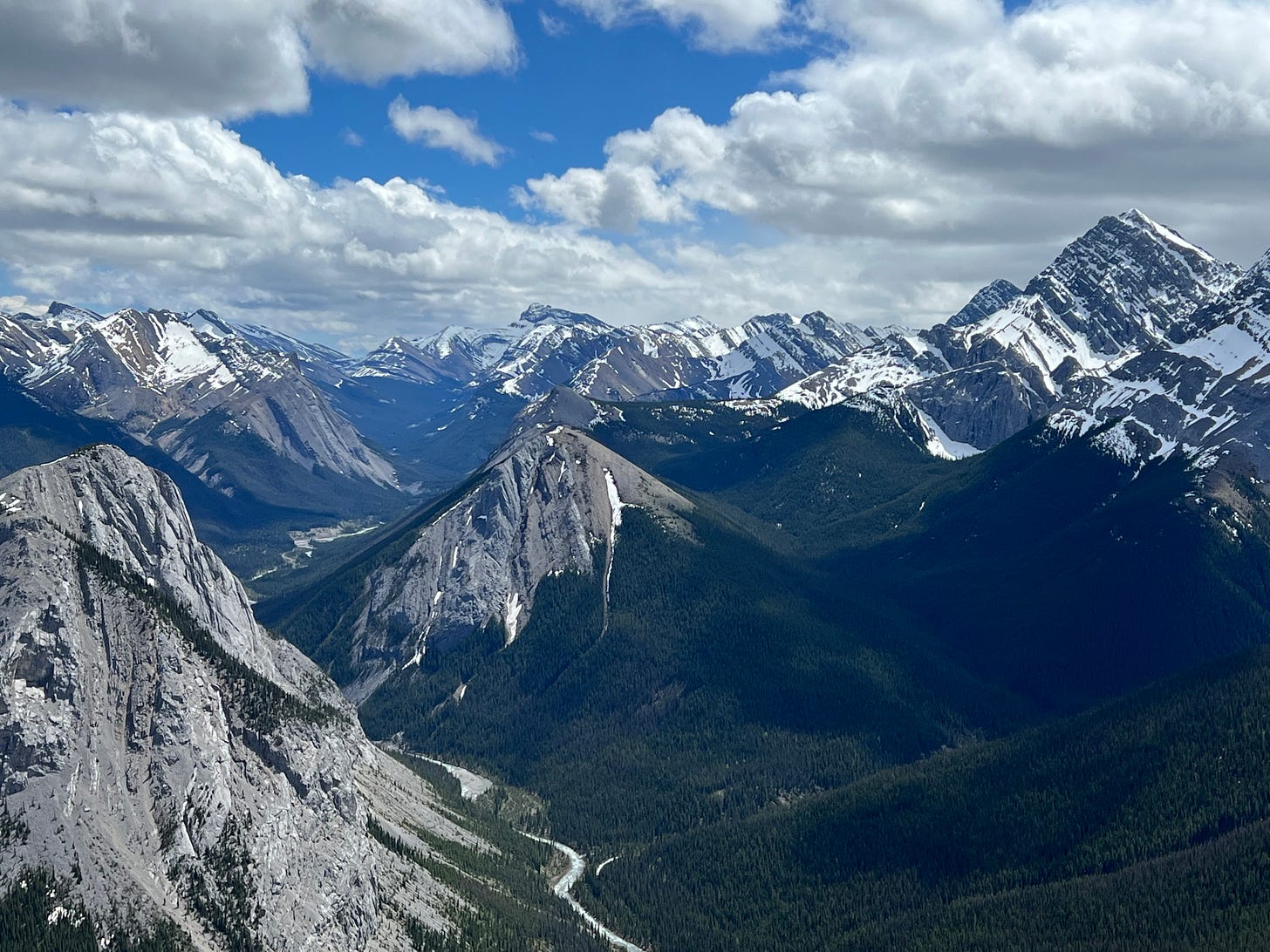
On day 3, despite no noted improvement in the trail conditions, we decided to go for one of the more challenging hikes anyway. Sulfur Skyline is widely considered one of the best hikes in the Canadian Rockies (and, after completion, I would argue, anywhere). A long ascent leads to a totally open ridge at the top with 360-degree panoramas of the surrounding mountains, rivers, and valleys.
This is normally a “difficult” hike, but the conditions made it even more challenging. The last kilometer-plus before the final ascent was largely hiked through packed snow, which explained why the Parks Canada website said, “cleats recommended.” Well, Gelsey at least had hiking boots, but this intrepid trekker was doing the hiking in shorts and sneakers.
Of course, this would turn out to be much more challenging on the way down than the way up! But before we could come down, we had to finish the ascent, and the last 400 meters or so were particularly challenging. After emerging from the tree line, most of the snow was gone, except for one very steep pitch of the hill which was evidently mostly shaded from the sun. Once we managed to get up that, there was another very steep and rocky ascent to the summit of the ridge.
Let’s just say that Gelsey did not enjoy this part of the hike. As someone who experiences a bit of (undiagnosed, but very real, as I can attest) acrophobia, the final ascent was a bit too steep, exposed, and close to the edge for Gelsey’s liking. The wind was also gusting strongly, and we weren’t the only ones having difficulty on this final part. But as something of a natural mountain goat, I loved it!
The views from the top were just absolutely spectacular. While Gelsey just sat down on some rocks to compose herself, I walked around, futilely trying to determine which of the 360 degrees was my favorite perspective from the top. Here are a few of my favorite photos.
Here’s just one more photo that lets you see both the parking lot (which I’ve crudely labeled) and the steepness of the final ascent.
I helped Gelsey navigate down the steep rocky section, and then we had a bit of fun human sledding down the steep snowy section. (There is video evidence of my thoroughly enjoying this.) There was a small plateau in the open before the final ascent, and after getting back down to this level, we ate lunch on a bench on a flat section overlooking the valley at a safe distance (for Gelsey) from the edge.
The next kilometer was quite challenging navigating packed snow on a steep descent. We each fell a few times into snowbanks. Finally, we made it back to the “good” condition part of the trail, and we were able to proceed back down the rest of the mountain. This took a surprisingly long time, and we both kept remarking, “wow, I can’t believe how far up we went!” The full distance of the hike was 8.8 kilometers, with 2,200 feet of vertical distance ascended.
But this is a hike with two rewards, rather than the typical one. While the views from the top were an amazing reward at the halfway point, the hot springs at the base of the hike were an excellent reward for making it all the way back down. We indulged for about 30 minutes, by which point, we were both feeling a bit better in the muscles but even more dehydrated.
I cannot recommend this hike enough… unless you have acrophobia.
Day 4, short walks to Athabasca and Sunwapta Falls
Day 4 was a driving day. We were transitioning from our Airbnb east of Jasper (near the town of Hinton) to near Lake Louise, which was about a 3.5-hour drive. We decided to stop at a few points along the way to admire the beautiful scenery.
The first couple of these stops were at viewpoints that involved a short walk out to observe a pair of waterfalls. Both contained an impressive amount of water at this time of year, and we were grateful they weren’t too far. Photos forthcoming in a post from Gelsey.
Day 4, Toe of the Glacier
At the Columbia Icefields Center, we opted to take the short, “moderate” hike to the Toe of the Glacier. In other words, we hiked out (and up) to the very end of the Athabasca Glacier. One of the interesting features of this hike was that there were signs showing how far the glacier had come in years past. It’s astonishing to see how much ice has been lost in the last 25-50 years.
The hike itself was a bit challenging. Through a completely barren landscape, we had to ascend some distance (made harder by our achy muscles from the ascent to Sulfur Skyline the day before) over a ridge left decades ago by the glacier itself. Then there was a very steep section of packed snow. The hike was also made more difficult by the katabatic winds. (Katabatic winds are a technical term for the cold air that blows down off a glacier, driven by the temperature differential with the warmer air below.) Thankfully it was only 2-3 kilometers roundtrip.
It was a kind of dreary day, but the glacier was still impressive. And the dreariness itself produced an odd effect with the barren landscape of nearly everything being in shades of gray.
Day 4, Lake Moraine Rockpile and Lakeshore
We hadn’t planned on going to Lake Moraine this day as well, but when we checked in at the hotel, I asked about when there was parking availability. The front desk clerk suggested very early mornings or evenings. We went into town and picked up a picnic dinner, thinking we would either eat it at Lake Louise or Lake Moraine, depending on parking availability. As it turned out, they opened the road up to Lake Moraine just as we returned from getting groceries, so we drove up to Lake Moraine.
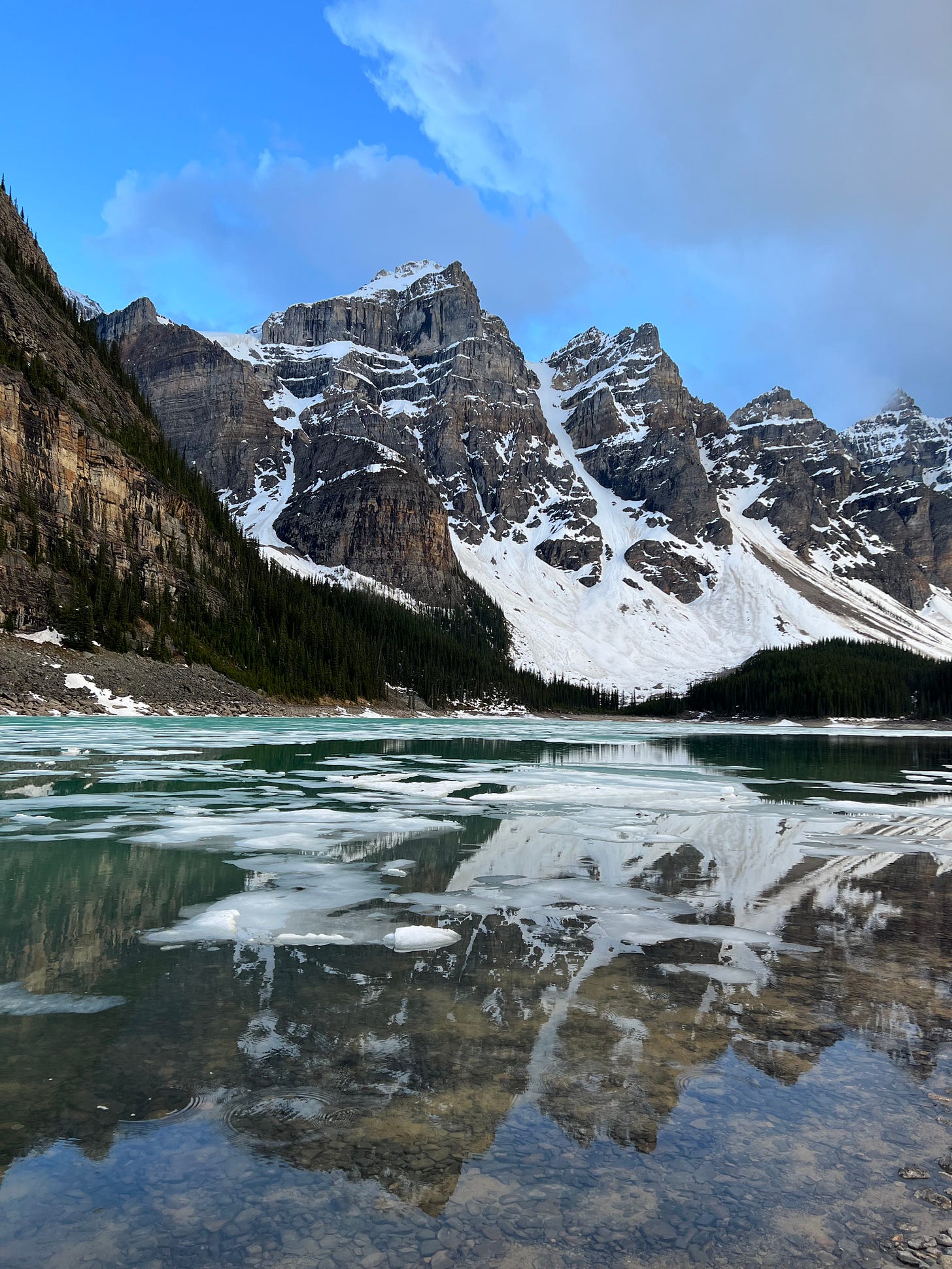
Lake Moraine has a few hikes, the more challenging of which are all not recommended due to snow and avalanche risks. The lake itself is already at altitude and was itself still partially frozen. It was quite obvious that any hike of any elevation from here would be a mess. So we just opted for two small-ish hikes that didn’t go too far from the parking lot.
First, we hiked up the rockpile at the near end of the lake and had a picnic dinner on top. Then we went down and hiked along the trail at the edge of the lake until it became snow-covered, at which point we switched to just hiking in the lakebed itself (since the water was quite low).
Day 5, Agnes Lake Teahouse
After a “recovery” day on day 4, we opted for another slightly more difficult hike on day 5. Although only technically classified as “moderate,” we made it a bit harder by starting the hike by our hotel (about a mile down the road from Lake Louise) rather than from the Lake Louise parking lot. The end result was a hike of about 1700-1800 feet in elevation gain.
The trail conditions were updated the day after we completed this hike and still said “do not recommend” because of the packed snow near the top portion of the hike. We had actually wanted to go even higher (which, if we had felt able, probably would have involved parking at the parking lot), but that section we saw in advance was even more precarious.
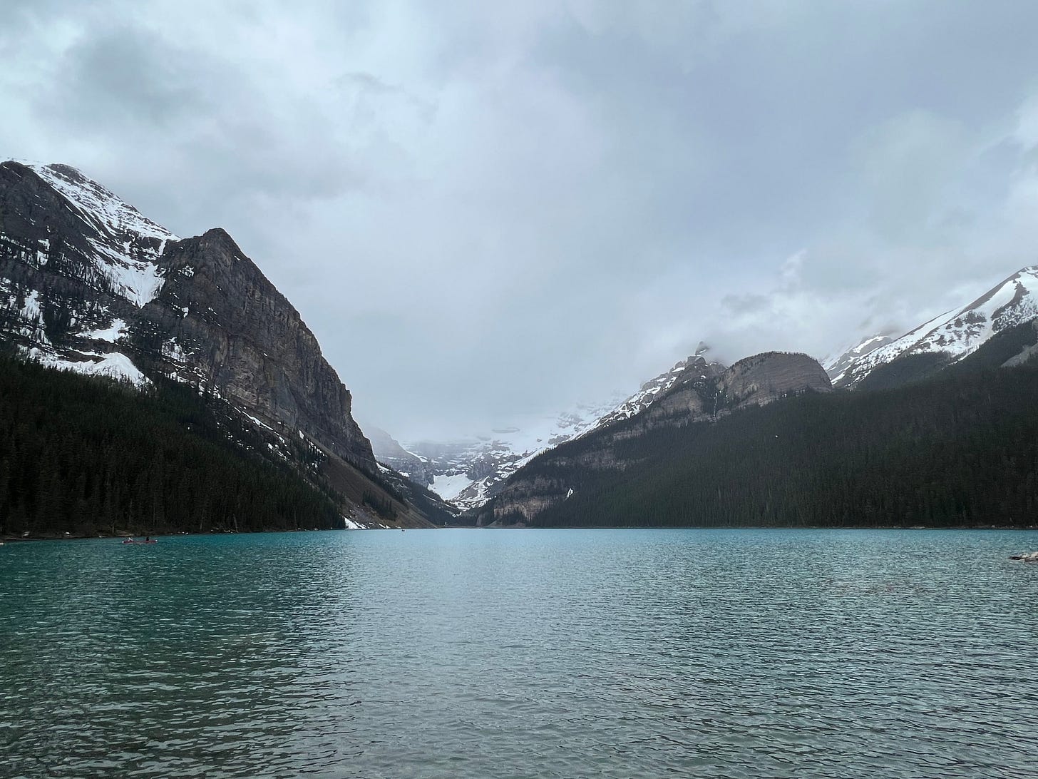
The trail itself was in good condition for the first 75% or so. It angles gradually (from above) away from the right bank of Lake Louise, offering glimpses of the turquoise blue lake through the trees to the left. But even this gradual angle is quite steep. Eventually it makes a hairpin turn (from which the best views of Lake Louise are available) and after going about halfway back (but much higher) towards the end of the lake near the parking lot, makes a left turn to take a few more switchbacks up the mountain to Mirror Lake.
We ate our picnic lunch at Mirror Lake (which was only slightly mirror-lake on account of its being partially frozen) before continuing up the final ascent (now almost entirely through packed snow) up to Lake Agnes and the teahouse there.
This final ascent provided the most interesting sight (Lake Louise water color aside) of the hike, which was a waterfall emerging from underneath a snowbank out of Lake Agnes.
Gelsey and I got beverages at the teahouse (a tea for me and a hot chocolate for her) and enjoyed the almost entirely frozen lake with the mountains in the background. It gave us a better appreciation for the hiking in Jasper, which wasn’t nearly as crowded. While not mobbed, the Lake Agnes area felt very busy. Slightly too many humans for our liking.
We then made our way back down (and down and down some more), once again remarking about how much we had ascended seemingly without realizing it. Occupying ourselves with a long hike was definitely worth it because by the time we reached the bottom, the clouds had mostly cleared and Lake Louise was an even more vibrant color.
Day 6, Peyto Lake Viewpoint
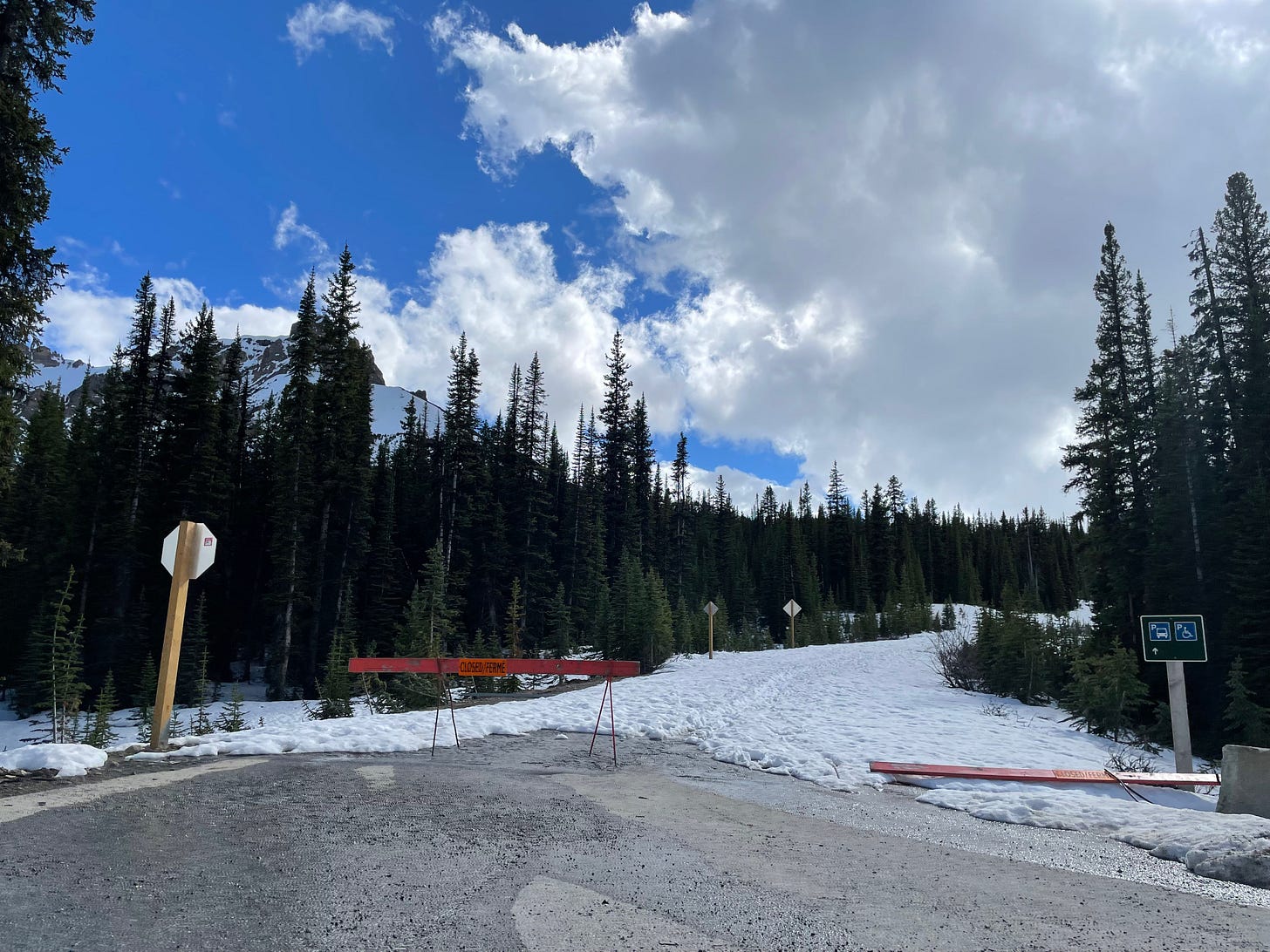
The Peyto Lake viewpoint is supposed to be handicap accessible, so we figured this couldn’t be too hard, right? Well, it turns out that the accessibility is only from the upper parking lot, which, as you can see, was not accessible.
So we parked at the lower parking lot and hiked out. This was maybe the steepest little hike we did, and it was almost (unsurprisingly, given the above photo) packed snow. Thankfully, it was only a little over one kilometer round-trip. The view was cool, although a bit diminished by the now-encroaching storm clouds and low level of water in the lake.
Conclusion
We had planned to take a hike or two in Kananaskis Country (south of Banff National Park) from our base in Canmore over the last couple of days here, but the region was getting absolutely pounded with rain. The same weather pattern has produced immense flooding and induced a park closure in Yellowstone. So we aborted those plans, and instead just enjoyed the cafes and galleries of Canmore for a day-and-a-half. Kananaskis Country will have to wait for a return trip, which we are both confident of making at some point in the not-too-distant future!


